Friday, 26 July 2013

Day 7: Friday - A moose long gone

Belvedere Mtn to Corless Camp

Given our spectacular 360deg view campsite we thought we’d get up early to see the sunrise. This partially worked to plan, and Billy leaped out of the tent at 5:15am. I rolled over and asked him to get me up if there was any colour in the sky. I snoozed for the next half an hour, so I guess the sunrise stayed behind the clouds this morning.

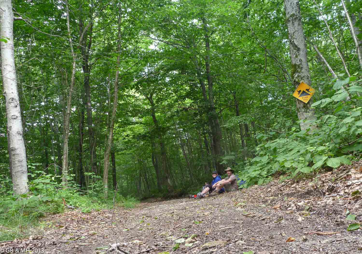
We were still ready to go early, and had headed down to Vt 118 (a crossing road) by 7am. Breakfast in a small glade of ferns and trees was a beautiful spot to rest and have a coffee.  

Breakfast in the forest near Vt 118
Crossing the road we bumped into another group of Summer Campers – Billy inadvertently let on about the guy with a broken arm we’d seen yesterday, which caused a bit of a ruckus and started a series of gossip and guessing that should keep the group entertained well into the morning.

We continued up to Devils Gulch – It’s amazing how we could picture what a gulch was, before we even saw it, or really knew what it was. Almost a canyon, more open, filled with mossy rocks to clamber over. 
Devil's Gulch
What we didn’t picture was a dinosaur like moose carcass lying in the middle of the track! Slightly greening, it looked like we had entered the Lost World.

Moose bones
Hoping to see a live moose, we followed the track through more lush forest. The track was clearer than in the previous sections we had walked, and the terrain undulating, so we quickly made it up to Spruce Ledge camp, where I had a sneaky nap, then past the two summits of Bowen Mountain, and after a short steep climb, to the top of Butternut Mountain, stopping along the way at an intersection with a skidoo track for lunch.

Nap time
Roadside lunch

Billy taught me a bit of Spanish along the way, and I am now well rehearsed with phrases such as “When is lunch?” (Quando ere la comida) and “I’m happy” (Estoy feliz.) Hopefully some help on our next trip!

Easy enough to talk and walk
We arrived at Corliss Camp, home for the night, at 5:45pm and met our fellow hikers – 2 guys from Vermont, who were into the last 3 days of their 24 day trek, and our forth group of Summer Campers, lining up for their nightly ration (beef jerky, beef stroganoff and chocolate brownie on the menu).

The Vermonters were on quite a journey, and they told us about 60mph winds atop Mansfield Mtn, sleeping in the Laundromat at Johnson, and the free 6 pack of beers they’d picked up from some overnight campers a week ago (a trip highlight).


Another great day – the longest so far, but only one more day until a refueling stop in Johnson. Yay!

The day in statistics
Total Miles: 12.2
Total up: 620m
Total down: 1,100m
No. of Moose: 1 (sort of)
Happy Place Fever rating: Billy – 0, Shell – 0 (but looking forward to a shower tomorrow!)


Thursday, 25 July 2013

Day 6: Thursday – Views into the future

Hazen’s Notch to Belvedere Mountain

This morning was bliss. We woke up late (at 7am) to sun streaming into the tent. Hooray!! No more rain walking. We snacked on some muesli then headed off – delaying our coffee and hot food until we’d reached a scenic spot.


Another morning of up. This place does great rugged trails and steep slopes, that’s for sure. Once again I found myself semi crawling up the track as we made our way up Haystack Mountain.  Along the way, we came across a second group of Summer Campers – these guys were looking more weary than the group from last night, and the first in line was nursing a broken arm.

The views were well worth the climbing effort! We emerged onto a small platform that looked South over the rest of the day’s hiking. It didn’t look as bad as the section we’d just completed, so we sipped our coffee in the sun and relaxed contentedly. Happy Place Fever rating back down to 0.

A great spot for breakfast 
We're heading that way!
After an hour or so, we had contemplated the scene sufficiently and started down a much more manageable slope. It even allowed us to chatter away for most of the time. A few more rises and we were at the next camp – Tillotson’s.

I made it this time!
Beaver ponds 

Both of us were feeling good, so we decided squeeze a few extra hours out of the day and aim for the next mountain – Belvedere. The map showed an interesting looking fire tower, so we thought we could check that out.

Another 2.8 miles – I was getting pretty weary and solely thinking about dinner by this point. But thoughts evaporated as we climbed higher and higher up the 70ft fire tower and took in the incredibly 360deg view. There were the mountains we’d just walked over – losing themselves in the haze of the horizon - we picked out Jay Peak with its gondola, Haystack mountain with its double hump top and our campsite from the night before on the side of Sugarloaf mountain.

Climbing the fire tower

Views of the Green Mountains - Jay Peak is the highest in this view
We turned and took in all that was to come – a daunting looking Mt Mansfield was the next highlight (we think about a week away on our trip). We’ve come so far and have so much further to go!

Mountain shadows
An unusual campsite
Delicious porcini mushrooms

Late night blogging

The day in statistics
Total Miles: 8.8
Total up: 620m
Total down: 270m
No. of Moose: 0

Happy Place Fever rating: Billy – 0, Shell – 0

Wednesday, 24 July 2013

Day 5: Wednesday – A wild day in the woods

Jay Camp to Hazen’s Notch
The dream of pancakes in the sun was quickly shattered at 3am when I woke to thundering rain on the tent fly, I was too tired to think much of it, and optimistically hoped it would have passed by the morning.

Unfortunately, at 6am it was still roaring outside, the wind whipping through the nearby forest that was thankfully sheltering our tent. We waited for an hour, then thought we’d better get moving. I looked around for my dry clothes… and discovered they were in a puddle at the bottom of the tent. Not good. The thought of putting on cold and wet clothes at the end of a day of being cold and wet was not that appealing! My happy place fever increased to 6…or maybe 7. Billy was very patient, and coaxed me out of bed. The rain stopped momentarily, and we had time to pack our gear before starting along the trail on a grey and cold day.

Cold & wet start to the day
We did have a lovely pancake breakfast, and full mugs of steaming coffee in the Jay Camp shelter not far below our camp. The clouds lightened and we took out our sopping gear to dry. Over our lengthy breakfast and a few bursts of sunlight, we actually managed to dry most things (at least until they were just damp). My happy place fever returned to 1.

Drying out at Jay Camp Shelter 

For the rest of the day we continued through the forest over a number of small mountains – Domey Dome, which was, unsurprisingly, quite dome shaped, Buchanan Mtn and Bruce Peak.


 We came across a couple from Vermont who were out for a day walk. The wife appeared to like the cold as much as I was, and she reminisced to us about her time in Palm Beach. We could tell she was hoping to be back there!

By 4:30pm, we’d finished our short day and arrived at Hazen’s Notch where we were greeted by “Smash” and his crew of Summer Campers, out on their wilderness hike.

The kids seemed tired from a big day of walking, but were happy to chat with us as they listened to music on their ipods. A couple of boys were from Venezuala, and another from Spain, with the rest of the girls from Montreal and other parts of the States. They were on a 2month Camp where they alternated weeks of mountain biking, hiking, rock climbing and canoeing. Sounded ideal to me!

Even better, their leader, Smash, had lit a huge fire, so we huddled around chatting and cooking well into the evening. He had a great gig! During the rest of the year he worked for a company called Natures Classroom, who bring children from public high schools to the forest to learn biology and ecology a week at a time. For many of them, it’s the first time they’ve left urban areas, so it’s very rewarding to see their reaction to the woods. In his time off, he leads Summer Camp groups. A great way to get paid for working outdoors!

Campfire with the "Wilderness" Summer Campers
We set up the tent on some dubiously spongy ground. Worried about another night of puddles in the tent we laid out a layer of ferns and birch bark. I felt like we’d landed on the set of “Survivor – the Woods” as we contemplated the positive attributes of the birch bark and looked for a tall enough tree for our bear bag of food.

Our Survivor tent footprint
 Luckily, both seemed successful and we had a much better night’s sleep than the day before.

The day in statistics
Total Miles: 7.0
Total up: 400m
Total down: 630m
No. of Moose: 0
Happy Place Fever rating: Billy – 0, Shell – 7 (morning) back down to 2


Tuesday, 23 July 2013

Day 4: Tuesday – Ups and Downs along the trail

Carleton Mtn to Jay Camp
First day of full hiking, awoke to the patter of rain on the roof of the tent, and Billy grinning contently at the coziness of being inside. It was quite early and we were keen to get started so we packed up our gear, in an elaborate rainy weather routine to avoid too many things getting wet.

We started off into the forest heading down Carleton Mtn, back up Blunt Mtn, then down again to Shooting Star shelter for breakfast. The ups and downs were something we’d get used to over the next few days – doesn’t appear to be much flat ground in this area.

Breakfast and a billy of coffee at Shooting Star Shelter
Our 2 hr walk helped us enjoy our scrambled egg breakfast and 1L+ of freshly brewed billy coffee. Yum!

Topping up our water supply
We took things leisurely, and didn’t start back much before 11am. Still a constant patter of rain overhead – sound of the plops on the leaves magnifying the sense of wetness.


 Also getting to know the different types of Vermont mud – there’s the sucking mud, that you lose your foot in, then makes a resounding “sschloook” as you pull in out and the hole you left refills slowly.

There’s skating mud, which takes you by surprise and projects you forward.

Then there’s fake mud. This isn’t mud at all as I discovered. We reached a lowpoint in the track that was particularly muddy with a couple of logs strewn along the path. I started out using the logs, but was finding it difficult to balance with my heavy pack, so thought “hey, how deep can this really be” and took a leap of faith. My right foot left the log and plunged into the mud. It kept going. I was only stopped by my left leg, which had concertinaed up underneath me. The right leg was now fully immersed in the fake mud, all the way up to mid thigh.

My foot disappears completely
Billy called “wait!” as he dived…into his bag to capture the moment on camera. I semi-rolled, semi crawled my way out in a bit of shock. Least I won’t be worried about skirting around puddles from now!


As we headed Dolls Mountain, a steep 300m climb, we passed another pair of hikers of disparate mindsets. The first had a happy place fever rating of 8.5 and rising, the second had a happy place fever rating of 3 and holding. We wondered what their lunchtime conversation would be like!

It was misty as we climbed up the steep track to Dolls Mtn. There were no views up in the clouds, but it was pretty in the forest, even though it was difficult and slow going to negotiate the mud, rocky slopes and tree roots of the trail that took up most of my conversation.

After a few more ups and downs, we spotted the roof of Laura Woodward shelter where we were planning to have lunch.  As we rounded the corner, a pack of 3 dogs jumped up, ran over and started aggressively barking – it wasn’t the welcome we were expecting. We had read dogs were allowed on the trail, and these were with a family that were out for a couple of days. It took a bit to calm them, but we settled down eventually into our space for a delicious lunch. Throughout all the excitement, we hadn’t noticed that the clouds had made way for some blue sky…yay!

We started out again enthusiastically now that the sun had returned and almost immediately hit an uphill. We were aiming for Jay Peak, the highest mountain in this section of the walk. It’s also a ski area, so about three quarters of the way up we came across a wide open expanse – a ski run. Whoa, this looked steep! Not my kind of blue run. 

A surprise ski run
We ducked back into the forest for another 20min, before emerging again at a second (black diamond style) ski run. This time we were getting close – I could see the blue sky beckoning. One last massive effort up an impossibly steep slope and we’d made it to the top!

Top of Jay Peak, Vermont
Billy greeted me with a wave and said we’d just missed the last gondola down! At least it was going in the wrong direction – otherwise I would have been disappointed (happy place fever rating 5), but as it was, I knew we were heading further south.

Last gondola back down
The sun was warming our backs as we started the descent towards Jay Camp. 

Billy makes his way down Jay Peak
At this point, we realized how late in the day it was, and the likelihood of the shelter being full, so we scouted out a sunny spot on a cleared ski run nearby. Delight! Dry clothes, warmth, we made dinner and dreamed about the pancakes we’d have in the sun the following morning.


The day in statistics
Total Miles: 8.8
Total up: 800m
Total down: 460m
No. of Moose: 0

Happy Place Fever rating: Billy – 0, Shell – 2-5